
FIELD TEST · PORTABLE FISH FINDER
How Well Does a Deeper Smart Sonar Work in Real-World Use?
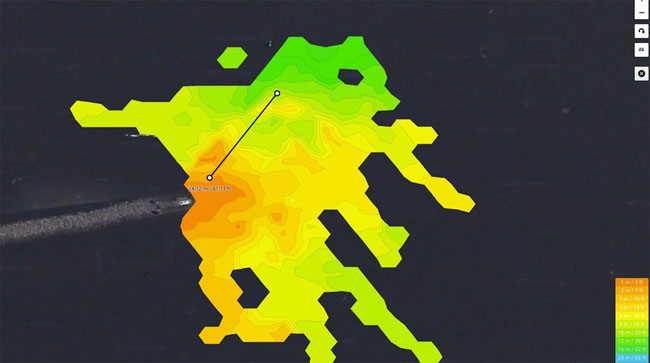
The original field test did not answer a laboratory question, but the more important one: Does a portable fish finder help when actually fishing? Our answer remains yes—if you use the device to explore and do not expect it to draw a ready-made fishing spot on the screen for you.
With the Deeper, the smartphone serves as the display. The transducer is not mounted on the boat's transom; it is cast or attached to a kayak, belly boat, or boat. This lets you scan spots that would be difficult to reach with a conventional fish finder. It is a real advantage, especially for shore anglers who frequently change spots or want to understand a new body of water.
What Does the Deeper Really Show While Fishing?
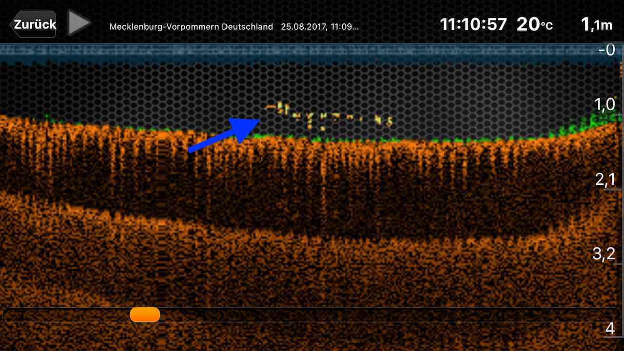
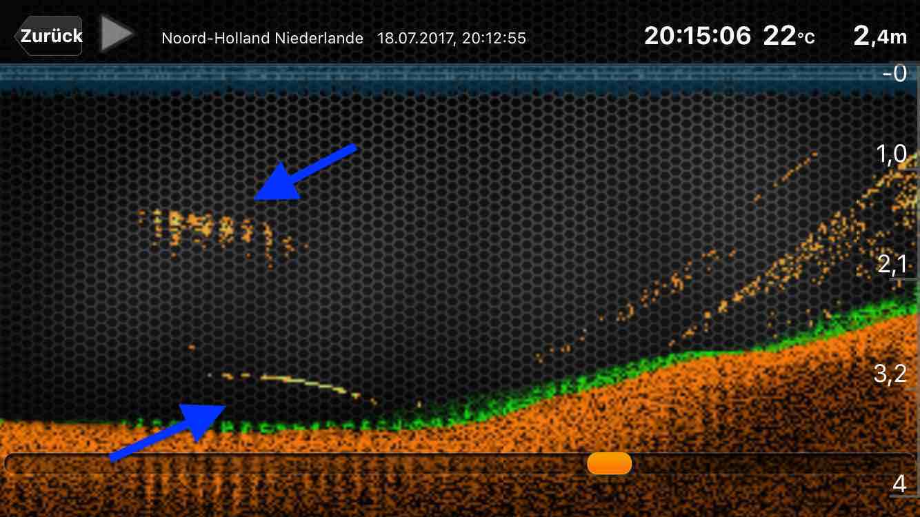
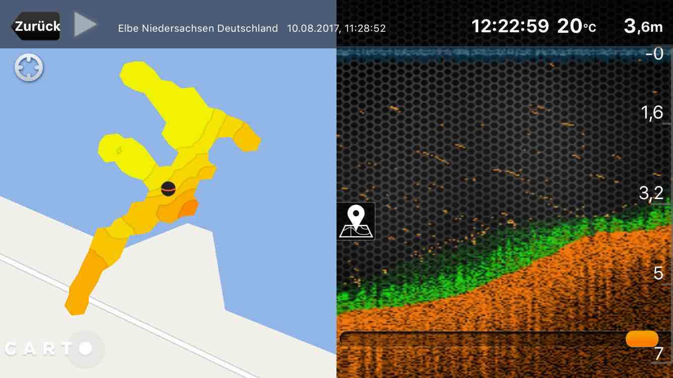
The transducer sends sound pulses toward the bottom. The time until the echo returns determines the depth, while the strength of the echo provides clues about hardness, structure, and objects. The app turns this into a graphical display. This is where the angler's work begins: A double or triple bottom line may indicate hard, dense bottom. A break in the line may be a drop-off, a depression, or a measurement artifact. That is why a second, controlled cast is so valuable.
In our field test, the map was always more valuable than the fish display alone. Once you have found a drop-off, slope, channel, or the outside bend of a groin, you can return to that information later and relate it to the season, temperature, water level, or forage. In this way, individual casts build a real mental map of the water.
How Do You Interpret Deeper Images Without Fooling Yourself?
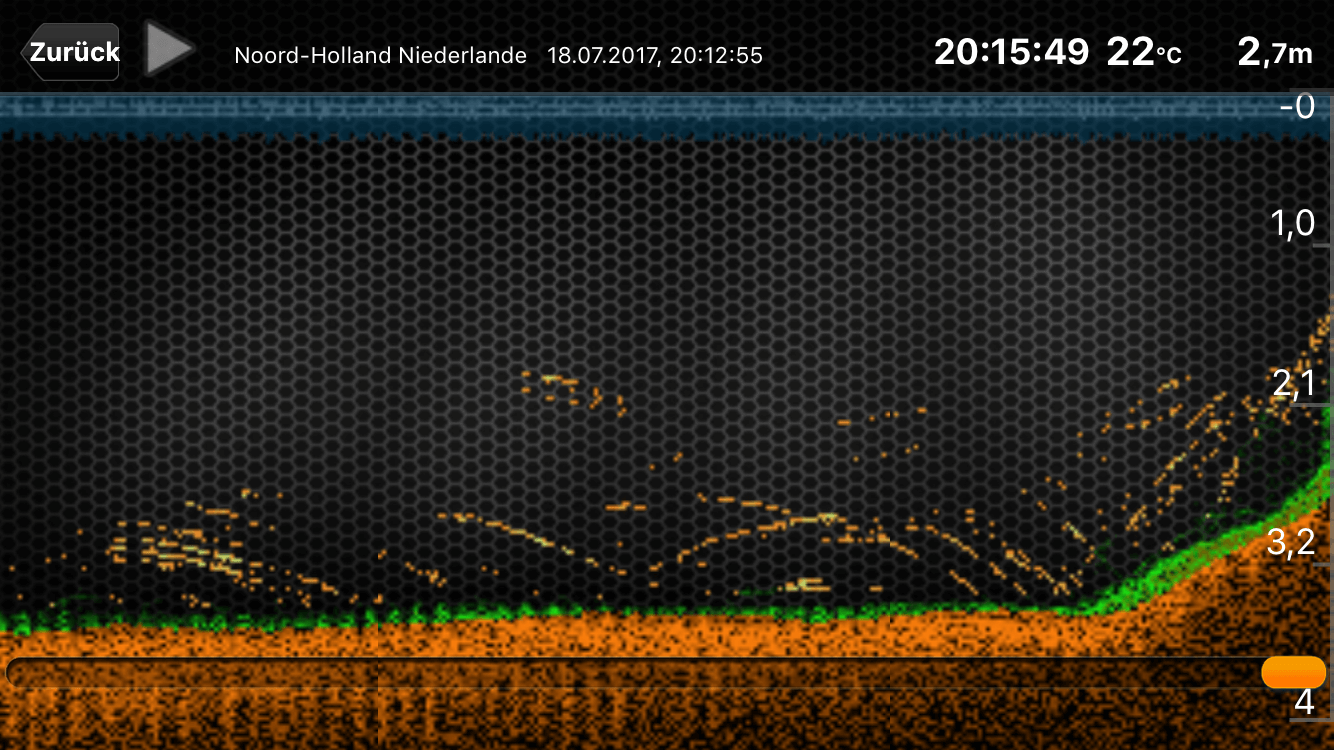
The old test shows genuine sonar images with hard bottom lines, fish arches, schools, and underwater humps. These examples remain important precisely because they show that a signal does not become more reliable just because it is given the most dramatic possible label. Individual arches may be fish. Fish icons are calculated by the app. They help beginners, but must not distract from depth, bottom, and structure.
We therefore recommend following a set sequence: First, look for a spot where your target species could be holding based on the shape of the water, light, temperature, current, or forage. Then check whether the sonar supports that assessment. Only after that should you consider lure size, color, and presentation. A Deeper helps you choose spots faster—it does not automatically help you catch fish faster.
To understand specific displays, then read our guide to Deeper images and hotspots. It takes you from the image to the structure and then to a decision on the water.
Which Deeper App Features Are Useful on the Water?
The app links the sonar image to the location. Do not just save a point; also note the water level, weather, wind, temperature, season, forage, and what you later tried at the spot. After a few sessions, this becomes more than a collection of attractive maps: You can identify which structure was actually productive at a given time.
The old app description mentioned weather forecasts, a fishing calendar, photos, and social features. App menus change regularly. That is why we do not treat individual buttons as timeless reasons to buy. The underlying principle remains relevant: Use the device to store your own data systematically and compare it later.
When Should You Choose the Narrow or Wide Sonar Cone?
In the original test, the 290-kHz setting on the older models was described as narrower and more detailed, while the wide cone combines a very large area into one image in shallow water. This field observation remains valid: The wider the cone, the more water and bottom are included in the same image. That is useful for searching, but it can obscure small depressions or precise transitions.
Modern models and their frequencies differ. The decision-making principle remains the same: cover the area first, then examine the details. If you do not know which cone to use, read the separate sonar cone guide—including the limitations of every sonar image.
How Do You Protect Your Deeper and Gear in Everyday Use?
The Five Minutes Before the First Cast
- Check the line, knots, and snap for damage.
- Screw the Deeper together securely and check the seal.
- Charge the battery and smartphone; check that the app and device firmware are up to date.
- Establish the Wi-Fi connection—the Deeper uses its own connection and is not a Bluetooth toy.
- Define a clear search question for the first area.
After use, rinse it with clean water, let it dry, and do not continue fishing with a damaged seal. For extended storage, follow the manufacturer's current battery recommendations. The old test advised against leaving the battery completely discharged, even outside the fishing season. This remains a sensible general rule, but the current instructions contain the exact requirements.
Who Is a Deeper Smart Sonar Worth It For?
The Deeper is not a substitute for knowledge of the water. But it provides information precisely where you previously had to guess. That was the key finding of the old test, and it remains unchanged: Search blindly less often, ask better questions, and check the most likely fishing spots first.
This article incorporates and reorganizes the content of the original field test: operation, handling, app, maps, sonar cones, accessories, and maintenance. Model and app details that may have changed since the original test are not presented as current product claims.