
DEEPER TIPS · READING SONAR IMAGES
How Do You Interpret Deeper Images and Use Them to Find Real Hotspots?
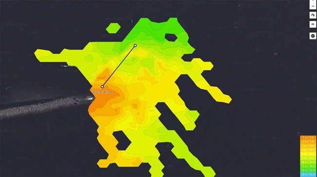
The original article demonstrated this exact principle in a video: The sonar image is not the hotspot itself. It is a tool that helps you answer your question on the water more effectively. Are the fish holding along the shallow drop-off today? Is the forage moving along the weedline? Is there a calmer, deeper area in front of the groyne? Asking questions like these will help you find relevant fishing spots faster than simply waiting for fish arches.
In What Order Should You Read a Deeper Sonar Image?
A Deeper creates a time-based image as you retrieve it. The left side shows what you passed over earlier; the right side shows what is currently beneath the transducer. The bottom line shows the contour. If it rises, the water is becoming shallower. If it falls, the water is becoming deeper. A drop-off can be sharp, gradual, or appear as only a small step. It is not automatically productive—but it can indicate a travel route, feeding spot, or transition.
So the first question is not “Is that a fish?” but: Where am I in the body of water, and what is changing here? A shallow plateau beside a deep channel, a weed edge at the transition to open water, or the current-sheltered side of a groyne provides a much better basis for choosing a spot than a single point on the image.
How Do You Identify Bottom Hardness, Drop-Offs, and Weeds in a Deeper Image?
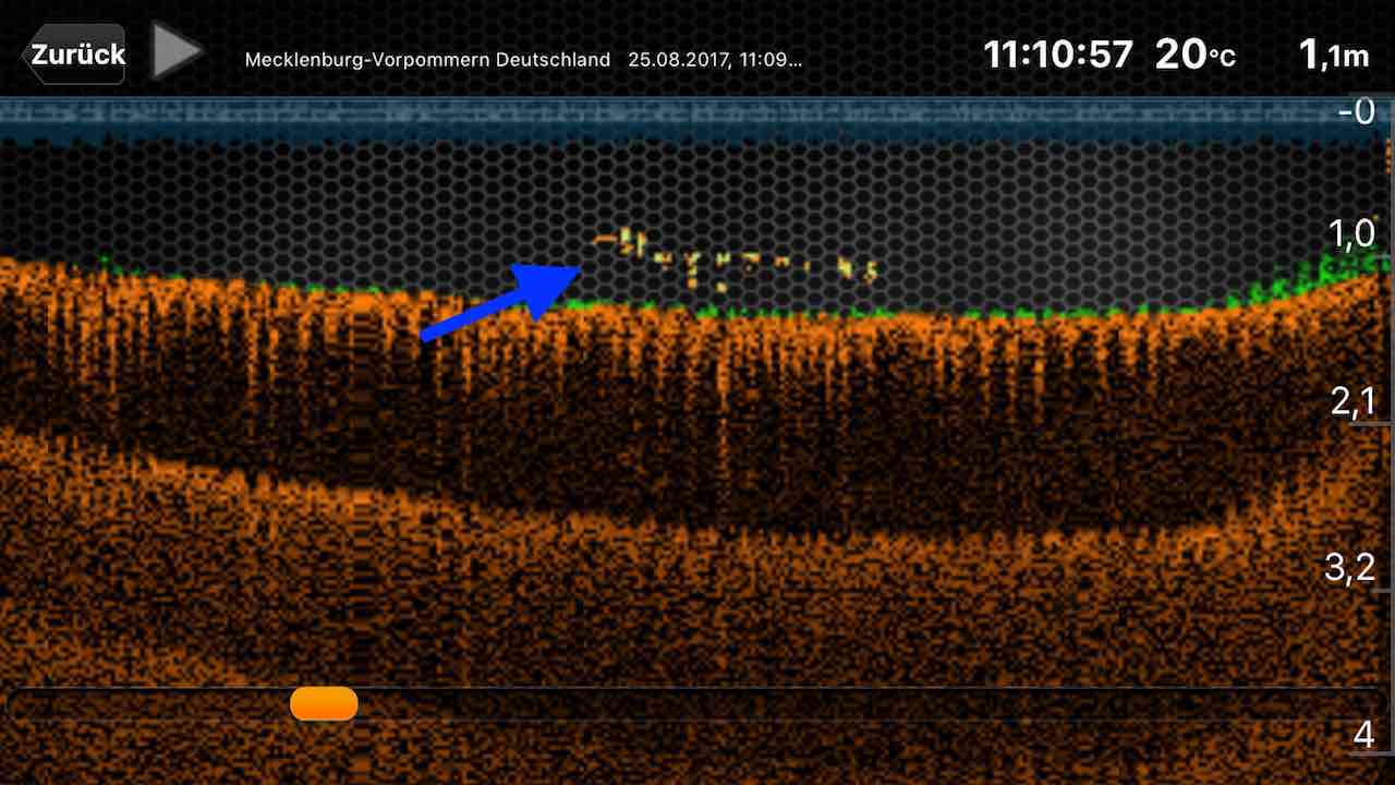
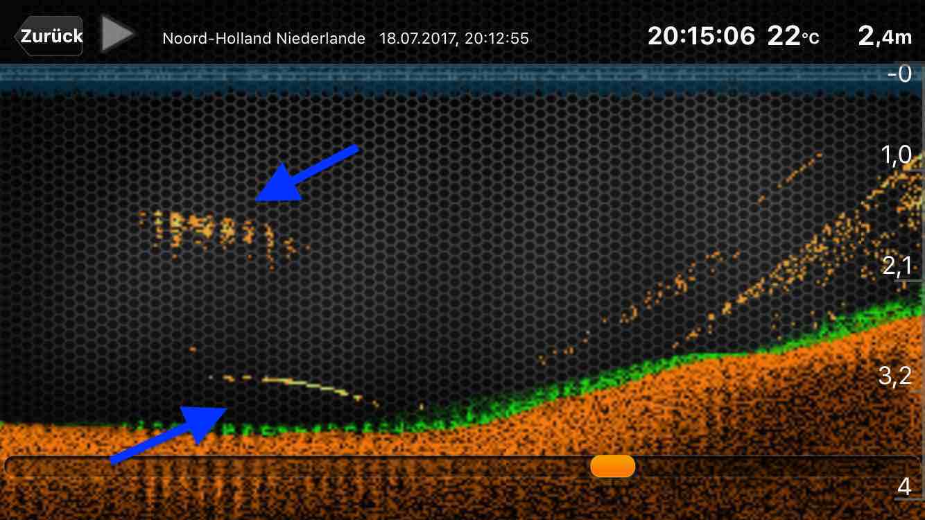
Comparison is important. If you retrieve the Deeper once across the spot and once along the drop-off, you can see whether the change is actually in the water or merely caused by the angle, movement, or cone. Steep drop-offs, large rocks, and weed beds in particular can significantly alter the image. A second cast takes minutes and can save you hours later at the wrong spot.
With weeds, the transition is often more important than the tallest plant. Predators may hold along the edge while coarse fish use the area. Carp may respond differently to softer bottom, mussel beds, or feeding routes. The sonar does not tell you which species is feeding there. It shows you the stage on which to test your target-fish strategy.
How Reliable Are Fish Arches and Fish Icons on a Deeper?
When a fish swims through the cone or the Deeper is pulled over it, the display may show an arch. But not every arch is equally meaningful. A wide cone combines a large area; a narrow cone often separates details better but covers less area. That is why cone selection is part of image interpretation. In our sonar cone guide, we explain the underlying logic step by step.
Good practice means marking an interesting return not as a “fish,” but as a question. Does it align with a drop-off? Is there forage there? Is the depth plausible for the season, light, and temperature? Only when several clues align does the signal become an area you fish deliberately.
When Does Structure Really Become a Fishing Hotspot?
An underwater drop-off is therefore never the whole plan. For perch, for example, ask: Is there forage, a drop-off leading to open water, or an area where schools can gather? For zander: Is there a transition between current, calm water, and depth? For pike: Does the structure lead to weeds, shallow water, or an ambush point? For carp: Is there a recurring feeding route, a transition, or a plateau where food can be found?
This is the connection between sonar and fishing that matters to us: not technology for its own sake, but informed spot selection. A Deeper narrows the search area. You then have to catch the fish using your knowledge of the fish, the body of water, and the conditions.
How Do Maps, Waypoints, and Notes Help You Find Hotspots Again?
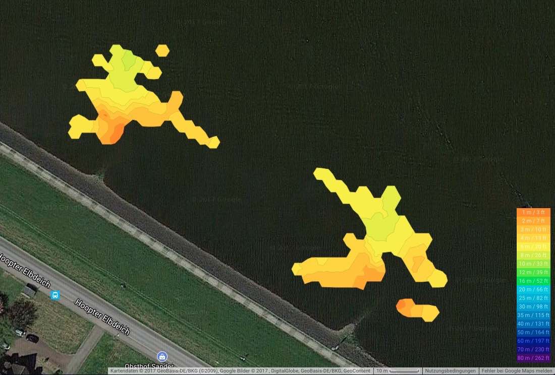
A screenshot without context is quickly forgotten. A clear entry, however, builds your knowledge of the water: “Outside edge of the groyne, 4.5 to 6 meters, hard transition, murky water, rising level, small baitfish visible.” You can test this hypothesis further on your next visit. This creates a genuine fishing log rather than a random collection of red dots.
How Do You Check a Potential Hotspot Before Fishing It?
- Search cast: Survey the area and find a conspicuous structure.
- Verification cast: Confirm the drop-off or transition from a second angle.
- Waypoint: Save the spot and note the context.
- Fishing plan: Match the target fish, depth, lure size, and retrieve to the structure.
- Review: Record a catch, follow, or unsuccessful attempt—this sharpens your map for next time.
The original video deliberately remains part of the article. The revised text turns it into a process you can use directly on the water: See the image, check the structure, form a hypothesis, and only then fish deliberately.
This article preserves the existing Deeper video and its core message: Sonar images help identify structures and hotspots. Clear questions, a reliable reading sequence, and the connection to spot selection have been added. Features and app menus may change depending on the model and version.