
UNDERSTANDING WATERS · BOTTOM AND FOOD
What does a hard or soft bottom reveal about potential fishing spots?
What do “hard” and “soft” underwater bottoms mean?
From shore, the bottom often looks uniform. Underwater, very different areas can lie within just a few meters of one another: a firm gravel strip next to softer sediment, a mussel bed at the edge of a plateau, a hard ledge in front of the weeds, or a muddy area in a quiet bay. Bottom composition is therefore more than just a technical term. It offers clues about what might grow, live, or accumulate there.
However, a hard knock when probing the bottom or a strong sonar return does not automatically prove the presence of “gravel” or “mussels.” The device, settings, depth, angle, slope, and water conditions affect the display. A soft impression may indicate mud, plant debris, or simply a different measurement situation. Treat the signal as a hypothesis and confirm it with multiple passes, a bottom sample, a map, or lure contact.
The better question is therefore not: “Is the bottom hard?” Instead, ask: What might have changed at this transition—and why might that matter for food, cover, or travel routes?
Why can the bottom influence potential fishing spots?
Firm bottoms may feature rocks, gravel, mussels, or other hard structures. They create surfaces where organisms can colonize and often differ clearly from the surrounding bottom. Softer areas may contain plant debris, detritus, larvae, worms, or other bottom-dwelling organisms. That can give a bottom-feeding fish a reason to visit the area; predators may find it indirectly interesting if baitfish feed there.
This does not mean “mussel bed = always catch fish” or “mud = worthless.” A firm gravel area may be empty if it lies isolated in the open basin. A soft bottom can be very interesting if a shallow area provides food and a nearby drop-off gives fish an escape route. Its function emerges only from the combination of bottom, food, depth, and season.
For example, plant debris lies on softer bottom along a weed edge, with a hard strip in front of it followed by a drop-off. This is not a secret spot, but it provides a logical search sequence. You can assess the food near the weeds, the bottom transition, and the connection to deep water separately instead of treating the entire shoreline alike.
Why are transitions between hard and soft bottoms often more informative than large areas?
Fish use transitions because different conditions can occur close together. A hard strip on softer bottom can separate a mussel zone from sediment. A firm ledge may support different growth than the area beside it. Softer material may accumulate in a channel while the bottom above it is different. These are not guarantees, but they give you a comparable structure.
On your first visit, the exact line is often more important than the area. Mark where your depth probe or sonar shows a transition, then ask: Does the line run parallel to the drop-off? Does it cut through a weedbed? Does it extend toward open water? Is it in a bay or at its mouth? This turns a color change on the map into a spatial decision.
The same reasoning applies to lure movement. Bottom contact is often easier to feel on hard bottom; on soft bottom, a heavy jighead may sink in or collect plant debris. If the lure suddenly feels different, that may be exactly where you should make a few targeted casts. The article Drop-Offs and Transitions shows how to fish these areas deliberately rather than simply crossing them.
How do you interpret bottom hardness using sonar, maps, and lure contact?
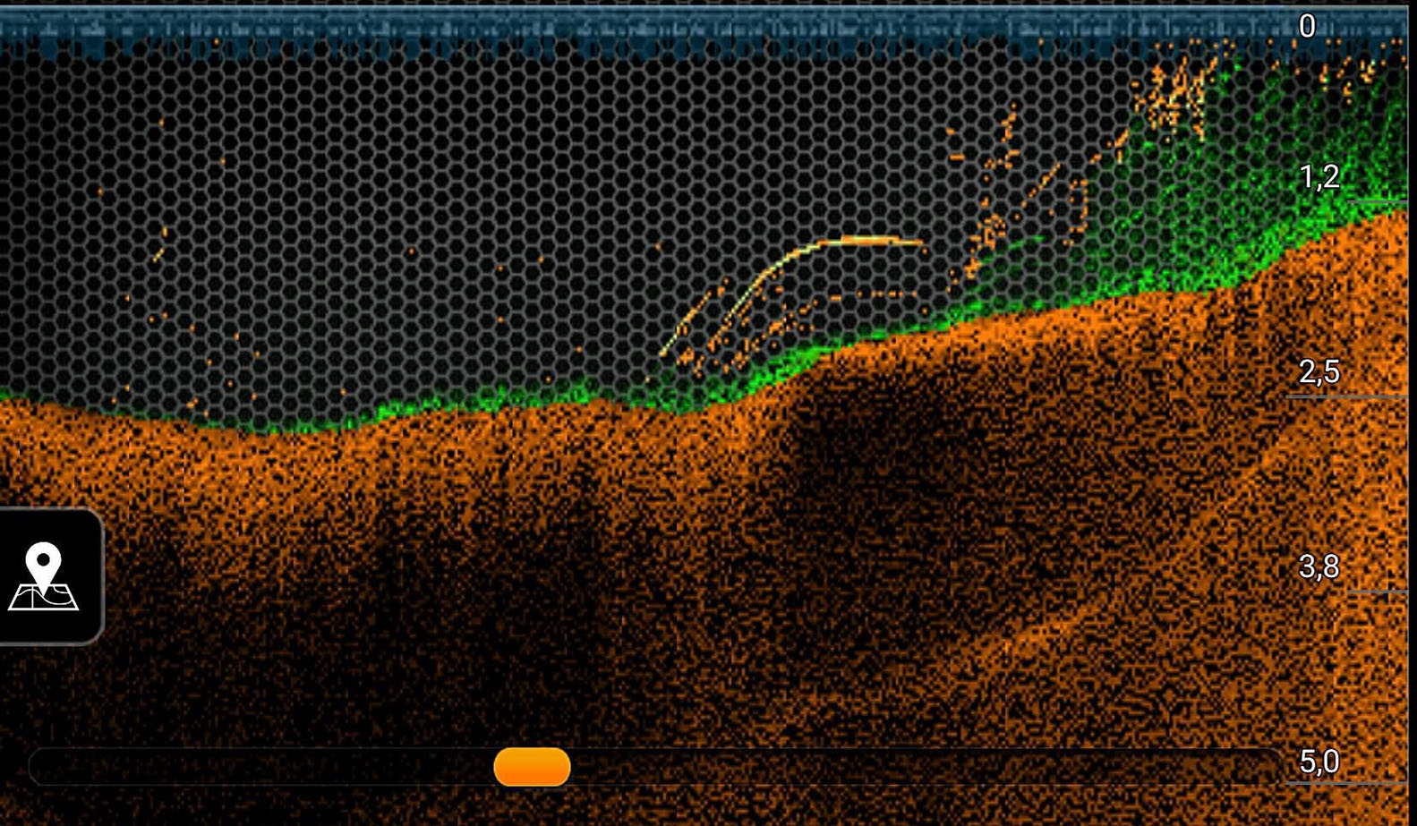
A sonar image can show strong and weak returns, a second bottom line, a hard transition, or a small rise. This is valuable because you do not have to cast blindly across every spot. But an image becomes interpretable only through comparison: the same settings, similar speed, multiple travel directions, and an assessment of what changes in depth or structure next to the signal.
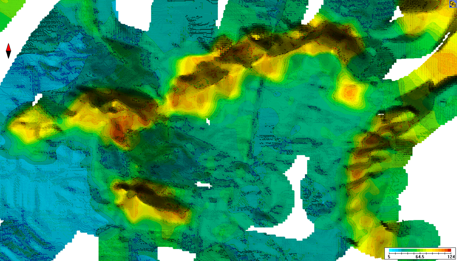
The same applies to bottom-hardness maps. The map above shows different readings or zones. Whether the colors represent hard, soft, or something entirely different depends on the dataset and its legend. Never apply one color scale blindly to another map. Use it to find notable transitions, then check the location in the actual waterbody.
From shore, lure contact remains a useful tool. Do you feel crisp, brief bottom contact? Does the lure suddenly stop softly? Does it snag on plants or mussels? Do not keep fishing as if nothing happened. Mark the transition, vary the angle, and keep the depth as consistent as possible. This helps you determine whether you found a single rock, a drop-off, or a longer bottom transition.
What can the bottom mean for perch, pike, zander, and carp?
Perch may use areas where small fish, small crustaceans, or other food are present. A mussel or gravel strip can be interesting if it connects to a drop-off, plateau, or school of baitfish. The key is not whether perch “eat mussels,” but whether the entire food chain and suitable hunting space are present.
Pike do not automatically hold in a location because the bottom is hard. The bottom matters to them when it influences vegetation, baitfish, or a clear hunting line. A firm area in front of the weeds, a small rise, or the transition from shallow to deeper water can provide a plausible search direction. Continue with Finding Pike in Lakes.
Zander may use structured transitions, drop-offs, and accessible forage. Whether a bottom transition fits depends on turbidity, depth, water movement, and forage. Therefore, use the bottom-hardness map as part of your analysis of the waterbody, not as a list of spots. The relevant location questions are covered in the Zander Overview.
Carp may feed very thoroughly across soft areas and transitions when larvae, worms, snails, mussels, or other natural food are accessible there. They do not need a “mud spot” simply because it is muddy. Accessibility, low disturbance, and a useful connection also matter.
How do you assess the bottom and a fishing spot on the water?
- Area A—hard or notable bottom: Look for a clear return, gravel strip, mussel area, or rise, and check its connection to deeper water.
- Area B—softer feeding area: Test a calmer area with plant debris, sediment, or potential bottom-dwelling forage—but only if it is accessible and not completely isolated.
- Area C—bottom transition: Fish the line between the two areas, especially where it meets weeds, a plateau, a drop-off, or a channel.
Do not compare everything at once. Initially fish all three areas with a similar lure, at a similar depth, and at a consistent, measurable speed. Only then change one variable. If the lure makes contact on hard bottom and sinks into soft bottom, a slight lift can help keep the presentation controlled. The lure should help you interpret the bottom, not churn it up until it becomes unreadable.
One catch does not automatically confirm the entire theory. The fish may have been there because of forage, wind, depth, or light. Therefore, record the bottom, depth, season, weather, signs of forage, and exact position together. Only repeated observations turn an interesting location into real knowledge of the waterbody.
What mistakes turn bottom hardness into a false formula for catching fish?
- “Red on the map always means hard.” Maps and devices use different scales. Always read the legend and check the actual location.
- “Hard bottom catches fish.” Without food, forage, depth, or a connection, gravel is still just gravel.
- “Soft bottom is worthless.” Sediment and plant debris can be part of a food chain. What matters is their function in the waterbody.
- “A knock on the bottom proves there is a mussel bed.” It could be a rock, a branch, a device artifact, or a brief transition. Repeat the observation.
- “Now I’ll fish only the bottom.” A fishing spot results from several factors: the shape of the waterbody, bottom, forage, season, light, wind, and presentation.
The greatest value of bottom hardness is not a new secret color on the map. It lies in deliberately looking for differences within the waterbody and connecting them with other clues. When you read the bottom as part of the system, you no longer choose fishing spots based only on the greatest depth or the most attractive shoreline.